Hiking routes in Danish Nature Park Vesterhavet
Hike on exciting routes in Danish Nature Park Vesterhavet. There are nine hiking routes in Danish Nature Park Vesterhavet’s guide.
There are nine hiking routes in Danish Nature Park Vesterhavet’s guide.
#1 Nymindegab
4.6 kilometres // 7.1 kilometres
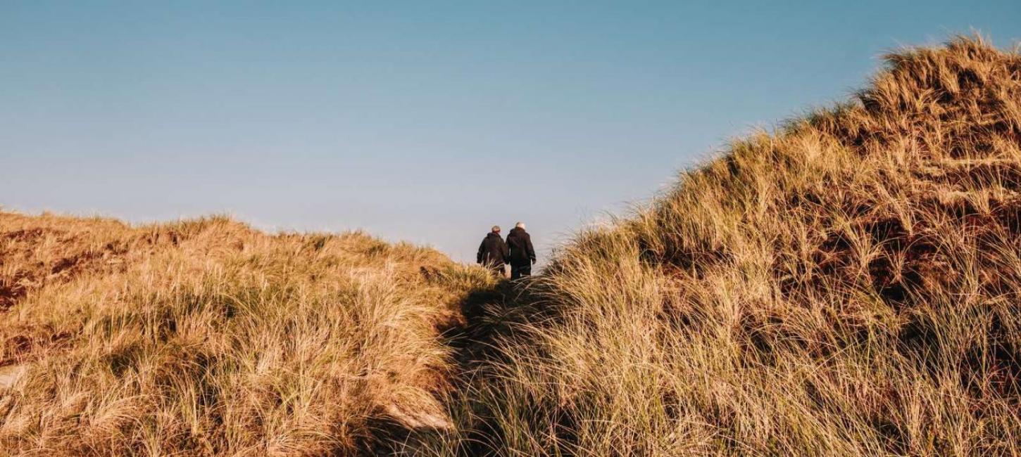
The viewpoint at Gammelgab with views of the sea and sand dunes.
The landscape between the North Sea and Ringkøbing Fjord is constantly in flux. It is exposed to the effects of both wind and seawater. Walk along Nymindestrømmen (stream). An awesome natural experience awaits you here! From the highest sand dunes, you can look out over the sea, fjord and beautiful sand dune landscapes. The route is not signposted but easy to follow.
To learn the history of the area, download the “Stories of Nature Park Vesterhavet” app. Nymindegab Museum is a good starting point. There is free wireless internet so you can download the app while you are there.
#2 Blåbjerg Plantation
2.5 kilometres // 11 kilometres // 1.5 kilometres
Viewpoint: Denmark’s highest sand dune is 64 metres high. On a clear day, the views from here seem unending. In the past, Blåbjerg was a beacon. Clearly visible from the sea, the dune became known as Blåbjerg because from a distance it looked like a remote blue mountain. The Blue Route takes you through very hilly terrain and to a parabolic dune, known locally as “Wuthering Heights”. This is a U-shaped dune, the arch of which curves away from the prevailing west winds. The Red Route leads to Rævebjerget. From Rævebjerget, there are fine views over the plantation and surrounding countryside.
The Yellow Route takes you close to Løvklinten sand dunes and out onto Lyngbos Hede heathlands. Here you may spot the European nightjar, woodlark, green, grey and white tones of the dunes, heathers, low-nutrient lakes, red deer and migratory birds.
#3 Filsø Lake
1-6 kilometres
Filsø Lake was reinstated in 2012. The lake now covers an area of about 915 hectares. Since the lake’s restoration, the natural environment has developed rapidly and is known locally as “the Filsø Miracle”.
A rich and varied bird and animal life awaits you at Filsø Lake. There is also a good chance that you will see red deer and white-tailed eagles. Learn more about Filsø in the ”Stories of Nature Park Vesterhavet” app.
There are several routes to choose from, varying from 1-6 km in length. For example, you can start at Nørrenge and hike to the Petersholm observation tower. Alternatively, you can walk from Filsøgård Farm along Dæmningsvejen to Langodde. From Langodde, you can see islands populated by birds and you get a good idea of the sheer size of the lake. At Langodde, you are welcome to watch the birds on and around the lake from the birdwatchers’ tower.
To follow Filsø’s hiking routes precisely, follow the signs.
#4 Børsmose Beach Kærgård Plantation
3.8 kilometres // 7.5 kilometres
Børsmose Beach
- Kærgård Plantation (South)
The Red Route crosses a beautiful sand dune landscape near Børsmose Beach and farther on into the southern part of Kærgård Plantation.
The Yellow Route brings hikers to The Octagon, a barbecue hut where guests are welcome to cook and enjoy their own food.
1.9 kilometres // 4.4 kilometres
Kærgård Plantation
– Oak trees buried in the sand
The Red and Yellow Routes both lead you to oak trees buried in the sand where you can walk on a level with the ancient oak tree crowns.
The Yellow Route also leads you through outstanding sand dune landscapes and to Gråmulebjerg, a sand dune that is 30 metres high. From the top, there are fantastic views of the sea, the plantation and Filsø, a reinstated lake. To learn the history of the area, download the “Stories of Nature Park Vesterhavet” app.
#5 Vejers
4.7 kilometres // 7.2 kilometres
In the southern sector of the plantation, the Red Route takes you to Vejers and then down to Lille Fælsig and Aarrild Sø Lake.
To the north, the Yellow Route leads to the beach through the woods near Strib Sø (lake), Ålestrømmen (stream), Bosdal and Klitsø (lake).
#6 Vrøgum Plantation
4.7 kilometres
The Red Route in Vrøgum Plantation’s beautiful environment. At the plantation perimeter and next to Vrøgum town lies Ballonparken, a recreational area with a children’s playground, BBQ hut and toilets. The plantation is very popular with trail runners and an annual Terrain Race (cross-country obstacle run/mud race) is held here. It is a great place to engage in all kinds of activities all year round.
#7 Aal Plantation
2.9 kilometres // 4.7 kilometres // 6.5 kilometres
The Yellow Hiking Route leads to Præstegårdssø Lake, where the German refugees bathed when they were interned at the refugee camp. Galloway cattle now graze in the same area.
The Blue Route is a signposted route with information boards telling the story of the refugee camp. German refugees were interned here in the period 1946-1949. It takes about three hours to cover the Blue Route. To learn more about the history of this area, download the ”Stories of Nature Park Vesterhavet” app.
The Red Route runs through the southern part of the historical Oksbøl refugee camp. There are many fragments of the past here.
#8 Bordrup
2.7 kilometres
A very short hiking trip in Oksby Plantation, from just east of Blåvand to the Husbjerg Klit sand dune that is 25 metres high. There is a magnificent view of Kallesmærsk Hede heathlands from the top of the dune.
The Red Route takes you through Bordrup Plantation to one of Denmark's largest migratory parabolic sand dunes. It moved incessantly until trees were planted on it in 1846.
On a clear day, you can see the sea quite clearly from point 100. Take care! There are many mountain bikes in this area.
#9 Ho Plantation
2.3 kilometres // 3.7 kilometres // 5 kilometres
Ho Plantation is one of the newest plantations. It was established in the 1950s.
Ho Plantation lies on the edge of the Danish Nature Park Vesterhavet and the Wadden Sea National Park.
The Yellow and Red Routes take you to the parabolic sand dune called “Jens Jessen’s Sands”. From the top of the dune, there are extensive views over the Danish Nature Park Vesterhavet and the Wadden Sea National Park.
Follow the signposted Green Route along the ancient coast at Sønderside. For a longer hike avoiding covering the same ground twice, follow the signposted Blue Route that leads through the plantation, up over the large parabolic dune called “Jens Jessen’s Sands” – and enjoy magnificent views from the top.
To learn more about the history of this area, download the “Stories of Nature Park Vesterhavet” app.